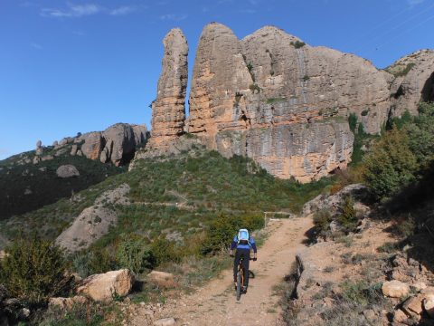
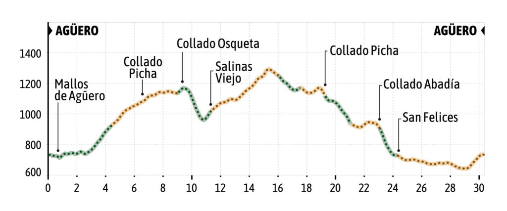
The route begins in the upper part of the village, just behind the hostel now turned into a residence for the elderly. Next to a small mallo there is an uphill track signposted with wooden signs indicating Vuelta a los Mallos de Agüero, which heads towards the base of the Mallos de Agüero passing under the Peña Sola and continuing along the edge of the mallos until it reaches a water reservoir. There we continue along a path to the right that leads to a
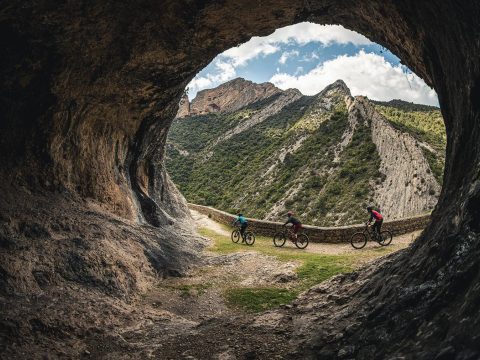
cave above the Foz of Pituelo. This section from Agüero to the cave is entirely on a path and is of great scenic beauty.
The trail goes down a short stretch until it crosses the ravine and from there begins a demanding uphill stretch on a broken path until it reaches a “borda”. There you push the bike a few meters until you reach an old track and turn left until you reach again a junction
with a main track. In this case, the route turns to the right during the ascent passing by several hills and until arriving at an area of meadows with a green shelter, known as Corrales de la Rabosera. There we ascend a few meters more on the track taking the track on the right until we connect with the path that ascends under the rock wall towards the Collado de la Osqueta (place where we can link with the route 1 Foz of Salinas).
The trail now turns downhill until it reaches just before the uninhabited village of Salinas Viejo. There we leave the main path and we take a path that is not very well marked on our left that ascends to the track. Once on the track, the route turns to the left and makes an ascent towards a hill, to then descend again and connect again with the path that flanks the
rocky wall where the Collado de la Osqueta is located. We go back over the hill and descend again towards the Corrales de la Rabosera and continue in the opposite direction until we reach the Collado Picha. In this return, instead of doing it by track, the route proposes to ascend a short and very rocky path and go down a firebreak also very rocky to cut and not repeat the same stretch of track between Collado de Rabosera and Collado Picha.
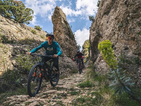
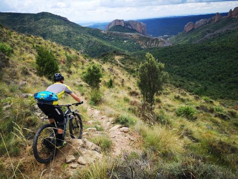
At Collado Picha we take a long and panoramic diagonal trail with beautiful views of the Mallos de Agüero and through an area of scrubland until we reach an old borda, known as Corral de Blasico. Before reaching the borda, we must be very attentive as the trail turns to the left to pass to the other side of the mountain through a rock gate that forces us to get off the bike. Behind Corral de Blasico, the trail continues towards the borda through which the
route has previously passed on the ascent from Foz de Pituelo. This stretch of trail to this borda is steeper and requires some very technical steps.
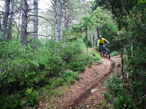
Before reaching the borda, we connect again with the track and in this case, turn left to ascend again to the junction of the main track. But in this case, we continue to the left downhill to reach a hill where the trail that descends to the village of San Felices begins. This stretch of trail through a pine forest is fast and with hardly any stones with some “slides” where you have to be careful. The trail leads to the ravine and forces us to cross it and pass through its left side through an area of marl (in the rainy season it can be very slow to go
through this section). The path ends in a curve of a track just in front of San Felices. When you reach the track, turn left and continue along a comfortable stretch of main track, ignoring all the crossings to the left and right until you reach the village of Agüero again